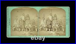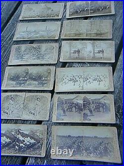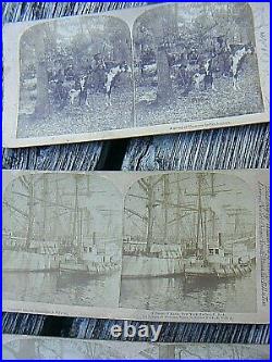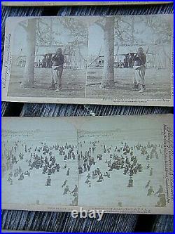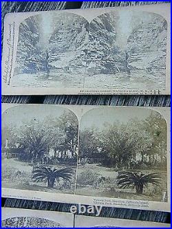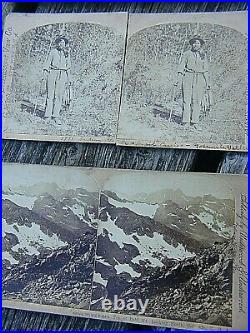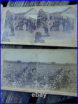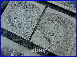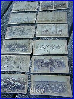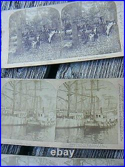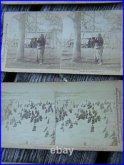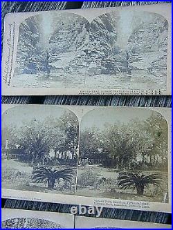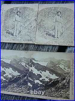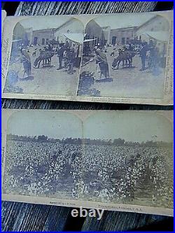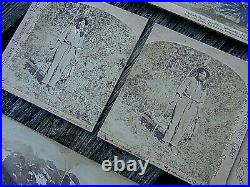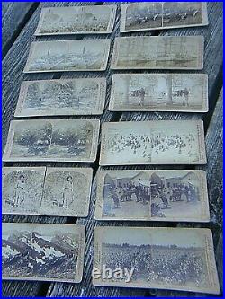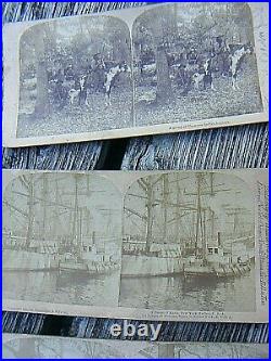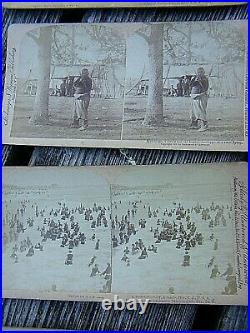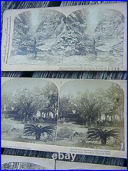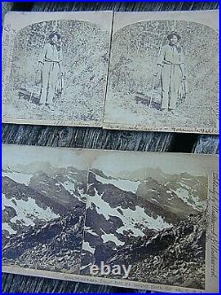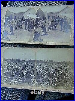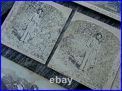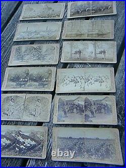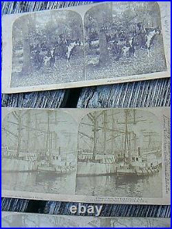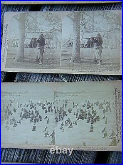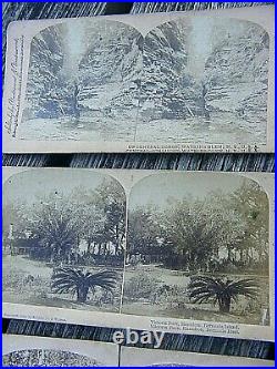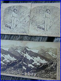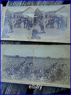
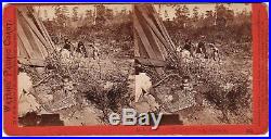
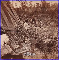


RARE old Stereoview Pho tograph. At the Rancherio, Mendocino County, California. Watkins’ Pacific Coast Series. For offer, a nice old stereop tican view card photo! Fresh from a prominent estate in Upstate, NY. Never offered on the market until now. Vintage, Old, Original. A Reproduction – Guaranteed! Image of a young Native American infant seen playing with a basket or cradleboard. A group of women are seen sitting in the background. In good to very good condition. If you collect 19th century Americana history, sv photography, 19th century American Indian culture, West, etc. This is a treasure you will not see again! Add this to your image or paper / ephemera collection. Watkins (18291916) was an American photographer of the 19th century. Born in New York, he moved to California and quickly became interested in photography. He focused mainly on landscape photography, and Yosemite Valley was a favorite subject of his. His photographs of the valley significantly influenced the United States Congress decision to preserve it as a National Park. Watkins was born on November 11, 1829, the eldest of eight children. His parents were John and Julia Watkins, a carpenter and an innkeeper. Born in Oneonta, New York, he was a hunter and fisherman and was involved in the glee club and Presbyterian Church Choir. [1] His true middle name is the subject of debate: some sources give it as Eugene while others give it as Emmons. In 1851, Watkins and his childhood friend Collis Huntington moved to San Francisco with hopes of finding gold. [1] Although they did not succeed in this specific venture, both became successful. Watkins became known for his photography skills, and Huntington became one of the Big Four owners of the Central Pacific Railroad. [3] This would later be helpful for Watkins. During the first two years in San Francisco, Watkins did not work in photography. He originally worked for his friend Huntington, delivering supplies to mining operations. He did this before working as a store clerk at a George Murrays Bookstore, [3] near the studio of Robert H. Vance, a well-known Daguerreotypist. An employee of Vances unexpectedly left his job, and Watkins agreeable personality led to his looking after the studio. Before his work with Vance, Watkins knew nothing about photography. Vance showed him the basic elements of photography, planning to return and retake the portraits himself. However, when he came back, he found that Watkins had excelled at the art while he was away and his customers were satisfied. Smelting Works, New Almaden, by Watkins. By 1858, Watkins was ready to begin his own photography business. He did many commissions, including Illustrated California Magazine for James Mason Hutchings and the documentation of John and Jessie Fremonts mining estate in Mariposa. [3] He made Daguerreotype stereoviews (two nearly identical images of the same scene, viewed through a stereoscope to create an illusion of depth) at the Almaden Quicksilver Mines. These were used in a widely publicized court case, which furthered his reputation as a photographer. One of Watkins’ iconic Yosemite photographs. In July 1861, Watkins made the decision that changed his career: he traveled to Yosemite. He brought his mammoth-plate camera (which used 18×22 inch glass plates) and his stereoscopic camera. [3] The stereoscopic camera was used to give the subject depth, and the mammoth-plate camera was used to capture more detail. These were some of the first photographs of Yosemite seen in the East. [5] In 1864, Watkins was hired to make photographs of Yosemite for the California State Geological Survey. In 1867, Watkins opened his first public gallery, in addition to sending his photographs to the Universal Exposition in Paris, where he won a medal. [1] This became his lavish Yosemite Art Gallery. He displayed over a hundred large Pacific Coast views in addition over a thousand images available through stereoscopes. [1] Despite his success as an artist, he was not successful as a businessman and ended up losing his gallery to his creditor J. Plantain Tree, by Watkins. Taber and “New Series”. Not only did Watkins lose his studio to Cook, he also lost its contents. [6] When Cook and photographer Isaiah Taber took over Yosemite Art Gallery, they began reproducing his work without giving him credit. Subsequently, he began recreating the images he lost, calling it the New Series. Watkins met Frances Sneed photographing in Virginia City, Nevada. [4] They became romantically involved in 1878 and were married a year later, on Watkins fiftieth birthday. The couple had two children: a daughter Julia in 1881, and a son Collis in 1883. Watkins began to lose his sight in the 1890s. His last commission was from Phoebe Hearst to photograph her Hacienda del Pozo de Verona. Watkins was unable to complete this job because of his failing sight and health. In 1895-96, his lack of work led to an inability to pay rent. The Watkins family lived in an abandoned railroad car for eighteen months. Watkins kept the majority of his work in a studio on Market Street. This studio was destroyed in the 1906 San Francisco earthquake and fire, with countless pictures, negatives and the majority of his stereo views. After this horrific loss, he retired to Capay Ranch. Napa State Hospital for the Insane. Three years after Watkins retired to Capay Ranch, he was declared incompetent and put into the care of his daughter Julia. She cared for him for a year before committing him to the Napa State Hospital for the Insane in 1910, at which point Frances Watkins began referring to herself as a widow. Watkins died in 1916 and was buried in an unmarked grave on the hospital grounds. Cathedral Rocks, 2600 feet, Yosemite Valley, Mariposa County, Cal, by Watkins. Watkins often photographed Yosemite and had a profound influence over the politicians debating its preservation as a national park. His photographs did more than just capture the national park; he created an icon. Half Dome, for example, did already exist, but Watkins photographs brought it to people in a way that they could experience it. It became iconic through his photographs, became something people wanted to see in person. His images had a more concrete impact on Yosemite becoming a national park than just encouraging people to visit. It is said that Senator John Conness passed Watkins photographs around Congress. [7] His photography was also said to have influenced President Abraham Lincoln and was one of the major factors in Lincoln signing the Yosemite Grant in 1864, a bill that declared Yosemite Valley inviolable. The bill paved the way for the 1872 creation of Yellowstone National Park, and the U. National Park System in its entirety. [4] One of Yosemites many mountains is named Mount Watkins in honor of Watkins part in preserving Yosemite Valley. The 1864 bill signed by Lincoln is often seen as the beginning of environmentalism in American politics. In accordance with his influence in preserving Yosemite and the beginning of the National Parks system, Watkins is seen as an important part of that. His photographs captured nature in a way that caught the eye of Americans. He created sublime images of wilderness, pristine landscapes untouched by humans. These images established icons that furthered environmentalist ideals, helping to back claims about preservation. Section of the Grizzly Giant, looking up, Mariposa Grove, Mariposa County, Cal, by Watkins. Watkins photographed one of the giant sequoia trees in California, the Grizzly Giant. His photo was created with one of his mammoth plates, which allowed him to photograph the entire tree, which had not been done before. Watkins, in addition to creating an image not seen before, was already very well known, and the image rapidly gained fame. Despite the fact that Watkins was attempting to preserve the trees, the way his photograph captured American audiences led to an increase in tourism in the area, which led to larger commercialization, which led to a diminishing of the giant sequoias. Mendocino County is a county located on the north coast of the U. As of the 2010 census, the population was 87,841. [5] The county seat is Ukiah. Mendocino County comprises the Ukiah, CA Micropolitan Statistical Area. It is located north of the San Francisco Bay Area and west of the Central Valley. The county is noted for its distinctive Pacific Ocean coastline, its location along California’s “Lost Coast”, Redwood forests, wine production, microbrews, and liberal views about the use of cannabis and support for its legalization. In 2009 it was estimated that roughly one-third of the economy was based on the cultivation of marijuana. The notable historic and recreational attraction of the “Skunk Train” connects Fort Bragg with Willits in Mendocino County via a steam-locomotive engine, along with other vehicles. This section does not cite any sources. Please help improve this section by adding citations to reliable sources. Unsourced material may be challenged and removed. (March 2013) (Learn how and when to remove this template message). Mendocino County was one of the original counties of California, created in 1850 at the time of statehood. Due to an initially minor white American population, it did not have a separate government until 1859 and was under the administration of Sonoma County prior to that. [8] Some of the county’s land was given to Sonoma County between 1850 and 1860. The county derives its name from Cape Mendocino (most of which is actually located in adjacent Humboldt County), which was probably named in honor of either Antonio de Mendoza, Viceroy of New Spain, 15351542 (who sent the Juan Rodríguez Cabrillo Expedition to this coast in 1542), or Lorenzo Suárez de Mendoza, Viceroy from 1580 to 1583. Mendocino is the adjectival form of the family name of Mendoza. Neither Spanish nor Mexican influence extended into Mendocino County beyond establishing two Mexican land grants in southern Mendocino County: Rancho Sanel in Hopland, in 1844 and Rancho Yokaya that forms the majority of the Ukiah Valley, in 1845. In the 19th century, despite the establishment of the Mendocino Indian Reservation and Nome Cult Farm in 1856, the county witnessed many of the most serious atrocities in the extermination of the Californian Native American tribes who originally lived in the area, like the Yuki, the Pomo, the Cahto, and the Wintun. The systematic occupation of their lands, the reduction of many of their members into slavery and the raids against their settlements led to the Mendocino War in 1859, where hundreds of Indians were killed. Establishment of the Round Valley Indian Reservation in March 30, 1870, did not prevent the segregation that continued well into the 20th century. Other tribes from the Sierra Nevada mountains were also relocated to the Round Valley Indian Reservation during the “California Trail Of Tears”, where the Natives were forced to march in bad conditions to their new home in Round Valley. [9] Many of these tribes thrown together were not friends with the other tribes they were forced to live with on the reservation, resulting in tensions still evident today. There are over 500 federally recognized tribes within the US, about half of which are associated with Indian reservations. Native Hawaiians are not counted as Native Americans by the US Census, instead being included in the Census grouping of “Native Hawaiian and other Pacific Islander”. The ancestors of modern Native Americans arrived in what is now the United States at least 15,000 years ago, possibly much earlier, from Asia via Beringia. A vast variety of peoples, societies and cultures subsequently developed. Native Americans were greatly affected by the European colonization of the Americas, which began in 1492, and their population declined precipitously mainly due to introduced diseases as well as warfare, territorial confiscation and slavery. After the founding of the United States, many Native American peoples were subjected to warfare, removals and one-sided treaties, and they continued to suffer from discriminatory government policies into the 20th century. Since the 1960s, Native American self-determination movements have resulted in changes to the lives of Native Americans, though there are still many contemporary issues faced by Native Americans. Today, there are over five million Native Americans in the United States, 78% of whom live outside reservations. When the United States was created, established Native American tribes were generally considered semi-independent nations, as they generally lived in communities separate from British settlers. The federal government signed treaties at a government-to-government level until the Indian Appropriations Act of 1871 ended recognition of independent native nations, and started treating them as “domestic dependent nations” subject to federal law. This law did preserve the rights and privileges agreed to under the treaties, including a large degree of tribal sovereignty. For this reason, many (but not all) Native American reservations are still independent of state law and actions of tribal citizens on these reservations are subject only to tribal courts and federal law. The Indian Citizenship Act of 1924 granted U. Citizenship to all Native Americans born in the United States who had not yet obtained it. This emptied the “Indians not taxed” category established by the United States Constitution, allowed natives to vote in state and federal elections, and extended the Fourteenth Amendment protections granted to people “subject to the jurisdiction” of the United States. However, some states continued to deny Native Americans voting rights for several decades. Bill of Rights protections do not apply to tribal governments, except for those mandated by the Indian Civil Rights Act of 1968. The Indigenous peoples of California (known as Native Californians) are the indigenous inhabitants who have lived or currently live in the geographic area within the current boundaries of California before and after the arrival of Europeans. With over forty groups seeking to be federally recognized tribes, California has the second largest Native American population in the United States. [1] The California cultural area does not conform exactly to the state of California’s boundaries. Many tribes on the eastern border with Nevada are classified as Great Basin tribes, [2] and some tribes on the Oregon border are classified as Plateau tribes. Tribes in Baja California who do not cross into California are classified as Indigenous peoples of Mexico. Main article: Classification of indigenous peoples of the Americas. Achomawi, Achumawi, Pit River tribe, northeastern California[4]. Atsugewi, northeastern California[4]. Cahuilla, southern California[4]. Chumash, coastal southern California[4]. Chilula, northwestern California[4]. Chimariko, extinct, northwestern California[5]. Cupeño, southern California[4]. Eel River Athapaskan peoples. Lassik, northwestern California[4]. Mattole (Bear River), northwestern California[4]. Nongatl, northwestern California[6]. Sinkyone, northwestern California[4]. Wailaki, Wai-lakki, northwestern California[4]. Esselen, west-central California[4]. Hupa, northwestern California[4]. Juaneño, Acjachemem, southwestern California. Karok, northwestern California[4]. Kato, Cahto, northwestern California[4]. Kitanemuk, south-central California[4]. Konkow, northern-central California[4]. Ipai, southwestern California[4]. Jamul, southwestern California[7]. Tipai, southwestern California and northwestern Mexico[4]. La Jolla Complex, southern California, c. Luiseño, southwestern California[4]. Maidu, northeastern California[4]. Nisenan, Southern Maidu, northern California. Miwok, Me-wuk, central California[4]. Coast Miwok, west-central California[4]. Lake Miwok, west-central California[4]. Valley and Sierra Miwok. Monache, Western Mono, central California[4]. Nisenan, eastern-central California[4]. Nomlaki, northwestern California[4]. Ohlone, Costanoan, west-central California[4]. Patwin, central California[4]. Suisun, Southern Patwin, central California. Pauma Complex, southern California, c. Pomo, northwestern and central-western California[4]. Salinan, coastal central California[4]. Serrano, southern California[4]. Shasta northwestern California[4]. Tataviam, Allilik (Fernandeño), southern California[4]. Tolowa, northwestern California[4]. Tongva, Gabrieleño, Fernandeño, San Clemente tribe, coastal southern California[4]. Tubatulabal, south-central California[4]. Wappo, north-central California[4]. Whilkut, northwestern California[4]. Wintu, northwestern California[4]. Wiyot, northwestern California[4]. Yana, northern-central California[4]. Yokuts, central and southern California[4]. Chukchansi, Foothill Yokuts, central California[4]. Northern Valley Yokuts, central California[4]. Tachi tribe, Southern Valley Yokuts, south-central California[4]. Yuki, Ukomno’m, northwestern California[4]. Huchnom, northwestern California[9]. Yurok, northwestern California[4]. Further information: History of the west coast of North America. A map locating the main tribes native to California (before Europeans’ arrival). Evidence of human occupation of California dates from at least 19,000 years ago. [14] Prior to European contact, California Indians had 500 distinct sub-tribes or groups, each consisting of 50 to 500 individual members. [3] The size of California tribes today are small compared to tribes in other regions of the United States. Prior to contact with Europeans, the California region contained the highest Native American population density north of what is now Mexico. [3] Because of the temperate climate and easy access to food sources, approximately one-third of all Native Americans in the United States were living in the area of California. Early Native Californians were hunter-gatherers, with seed collection becoming widespread around 9,000 BC. [3] Due to the local abundance of food, tribes never developed agriculture or tilled the soil. Two early southern California cultural traditions include the La Jolla Complex and the Pauma Complex, both dating from ca. From 3000 to 2000 BC, regional diversity developed, with the peoples making fine-tuned adaptations to local environments. Traits recognizable to historic tribes were developed by approximately 500 BC. The indigenous people practiced various forms of sophisticated forest gardening in the forests, grasslands, mixed woodlands, and wetlands to ensure availability of food and medicine plants. They controlled fire on a regional scale to create a low-intensity fire ecology; this prevented larger, catastrophic fires and sustained a low-density “wild” agriculture in loose rotation. [17][18][19][20] By burning underbrush and grass, the natives revitalized patches of land and provided fresh shoots to attract food animals. A form of fire-stick farming was used to clear areas of old growth to encourage new in a repeated cycle; a permaculture. Main article: Spanish colonization of the Americas. Different tribes encountered non-native European explorers and settlers at widely different times. The southern and central coastal tribes encountered Spanish and British explorers in the mid-16th century. Tribes such as the Quechan or Yuman Indians in present-day southeast California and southwest Arizona first encountered Spanish explorers in the 1760s and 1770s. Tribes on the coast of northwest California, like the Miwok, Yurok, and Yokut, had contact with Russian explorers and seafarers in the late 18th century. [citation needed][21] In remote interior regions, some tribes did not meet non-natives until the mid-19th century. Further information: Mission Indians. The Spanish began their long-term occupation in California in 1769 with the founding of Mission San Diego de Alcalá in San Diego. The Spanish built 20 additional missions in California. [23][24] Their introduction of European invasive plant species and non-native diseases resulted in unintended havoc and high fatalities for the Native Californian tribes. Rock art at Coso in the Mojave desert. Native American culture in California was noted for its rock art or petroglyphs. The population of Native California was reduced by 90% during the 19th centuryfrom more than 200,000 in the early 19th century to approximately 15,000 at the end of the century, mostly due to disease. [16] Epidemics swept through California Indian Country, such as the 1833 malaria epidemic. Early to mid 19th Century, coastal tribes of northwest California had multiple contacts with Russian explorers due to Russian colonization of the Americas. At that time period, Russian exploration of California and contacts with local population were usually associated with the activity of the Russian-American Company. A Russian explorer, Baron Ferdinand von Wrangell, visited California in 1818, 1833, and 1835. [25] Looking for a potential site for a new outpost of the company in California in place of Fort Ross, Wrangells expedition encountered the Indians north of San Francisco Bay and visited their village. In his notes Wrangell remarked that local women, used to physical labor, seemed to be of stronger constitution than men, whose main activity was hunting. Local provision consisted primarily of fish and products made of seeds and grains: usually ground acorns and wild rye. Wrangell surmised his impressions of the California Indians as a people with a natural propensity for independence, inventive spirit, and a unique sense of the beautiful. Another notable Russian expedition to California was the 13 months long visit of the scientist Ilya Voznesensky in 18401841. Voznesensky’s goal was to gather some ethnographic, biological, and geological materials for the collection of the Imperial Academy of Sciences. He described the locals that he met on his trip to Cape Mendocino as “the untamed Indian tribes of New Albion, who roam like animals and, protected by impenetrable vegetation, keep from being enslaved by the Spanish”. In 1834 Mexico secularized the Church’s missions and confiscated their properties. But the new government did not return their lands to tribes but made land grants to settlers of at least partial European ancestry. Many landless Indians found wage labor on ranches. Following the United States victory in the MexicanAmerican War, it took control of California in 1848 with the signing of the Treaty of Guadalupe Hidalgo. Its administrators worked to honor Mexican land grant title but did not honor aboriginal land title. California Gold Rush (18481855). Further information: California Gold Rush. Balthazar, Inhabitant of Northern California, painting by Mikhail Tikhanov. Most of inland California including California deserts and the Central Valley was in possession of the local tribes until the acquisition of Alta California by the United States. As the wave of immigrants from the United States started to settle inland California during the Gold Rush, conflicts between the aborigines and the immigrants started to arise. The series of massacres, battles, and wars between the United States and the indigenous peoples of California lasting from 1850 to 1880 is referred to as the California Indian Wars. After guns and horses were introduced to the indigenous peoples of California in the beginning of the 19th century, the tensions between the neighboring tribes started to increase. In combination with the mass migration, that caused dramatic changes. When in 1846 the Applegate Trail cut through the Modoc territory, the migrants and their livestock damaged the ecosystem that the locals were dependent on. Some anthropologists insist that the indigenous resistance is often used to camouflage genocide in colonial history. For instance, the final stage of the Modoc Campaign was triggered when Modoc men led by Kintpuash (AKA Captain Jack) murdered General Canby at the peace tent in 1873. However, its not widely known that between 1851 and 1872 the Modoc population decreased by 75 to 88% as a result of seven anti-Modoc campaigns started by the whites. [29] There is evidence that the first massacre of the Modocs by the white men possibly happened as early as 1840. According to the story told by a chief of the Achumawi tribe (neighboring to Modocs), a group of trappers from the north stopped by the Tule lake around the year 1840 and invited the Modocs to a feast. As they sat down to eat, the cannon was fired and many Indians were killed. The father of Captain Jack was among the survivors of that attack. Since then the Modocs resisted the intruders notoriously. See also: California Genocide. During the end of the 19th Century and the beginning of the 20th century, the government attempted to force the indigenous peoples to break the ties with their native culture and tribalism and assimilate with the white society. In California, the federal government established such forms of education as the reservation day schools and American Indian boarding schools. Some public schools would allow Indians to attend as well. Poor ventilation and nutrition (due to limited funding), and diseases were typical problems at schools for American Indians. In addition to that, most parents disagreed with the idea of their children being raised as whites: at boarding schools, the students were forced to wear European style clothes and haircuts, were given European names, and were strictly forbidden to speak indigenous languages. The Native American community recognized the American Indian boarding schools to have oppressed their native culture and demanded the right for their children to access public schools. In 1935 the restrictions that forbid the Native Americans from attending public schools were officially removed. Since the 1920s, various Indian activist groups were demanding that the federal government fulfil the conditions of the 18 treaties of 18511852 that were never ratified and apparently, were classified. [32] In 1944 and in 1946 the native peoples brought claims for reimbursements asking for compensations for the lands affected by treaties and Mexican land grants. Throughout the 20th century, the population of indigenous peoples of California gradually rose. This population grew by 15% between 2000 and 2010, much less than the nation-wide growth rate of 27%, but higher than the population growth rate for all races, which was about 10% in California over that decade. Over 50,000 indigenous people live in Los Angeles alone. According to the National Conference of State Legislatures, there are currently over one hundred federally recognized native groups or tribes in California including those that spread to several states. [35] Federal recognition officially grants the Indian tribes access to services and funding from the Bureau of Indian Affairs, and Federal and State funding for Tribal TANF/CalWORKs programs. Yokut woman basket maker, Tule River Reservation ca. Basket making was an important part of Native American Californian culture. [36] Baskets were both beautiful and functional, with a wide variety of shapes and sizes based on their function, and of different patterns. Baskets were generally made by women. Many tribes in Central California and Northern California practised the Kuksu religion, espcecially the Nisenan, Maidu, Pomo and Patwin tribes. [37] The practice of Kuksu included elaborate narrative ceremonial dances and specific regalia. A male secret society met in underground dance rooms and danced in disguises at the public dances. In Southern California the Toloache religion was dominant among tribes such as the Luiseño and Diegueño. [39] Ceremonies were performed after consuming a hallucinogenic drink made of the jimsonweed or Toloache plant (Datura meteloides), which put devotees in a trance and gave them access to supernatural knowledge. Native american culture in California was also noted for its rock art, especially among the Chumash of southern California. [40] The rock art, or pictographs were brightly colored paintings of humans, animals and abstract designs, and were thought to have had religious significance. The item “RARE Stereoview Photo Watkins Native American Rancherio Mendocino County CA 1865″ is in sale since Saturday, February 2, 2019. This item is in the category “Collectibles\Photographic Images\Vintage & Antique (Pre-1940)\Stereoviews”. The seller is “dalebooks” and is located in Rochester, New York. This item can be shipped worldwide.
- Region of Origin: US
- Framing: Unframed
- Size Type/Largest Dimension: Small (Up to 7″)
- Modified Item: No
- Country/Region of Manufacture: United States
- Listed By: Dealer or Reseller
- Date of Creation: 1860-1869
- Color: Sepia
- Photo Type: Stereoview
- Subject: Historic & Vintage
- Original/Reprint: Original Print

